PCI Software Pvt. Ltd. is the authorized reseller for DAT/EM products in India and SAARC Countries. To purchase DAT/EM products please contact the PCI Sales Team.
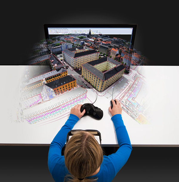
DAT/EM Systems International offers a suite of photogrammetric software solutions, including Summit Evolution and LandScape, which are efficient digitizing and editing tools to extract 3D vector features from stereo imagery or point clouds.
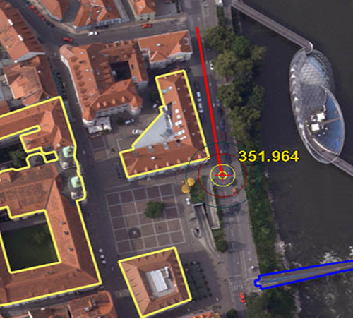
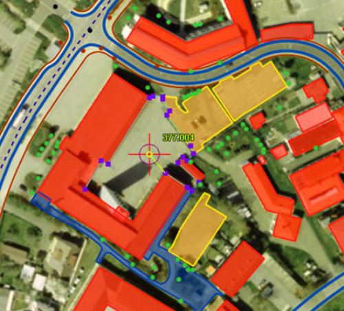
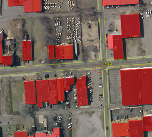
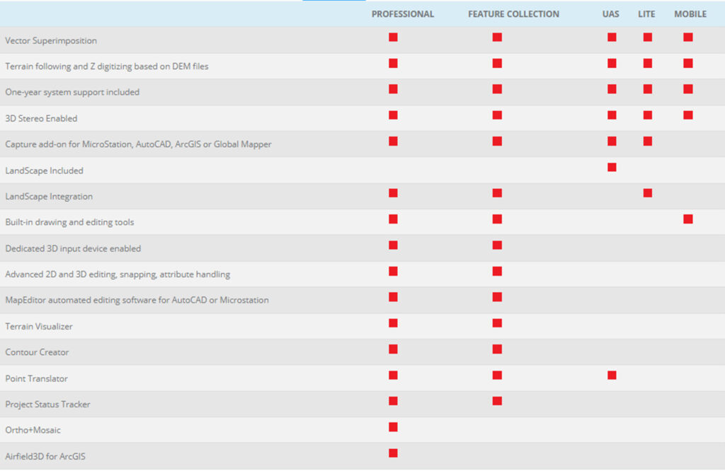
The Summit Evolution 3D digitisers from DAT/EM are affordable, user-friendly, Windows-based, best-in-class digital photogrammetric systems. The tools are powerful, for viewing, analysing, manipulating, and processing 3D geodata. There are three levels of Summit Evolution: Professional, Feature Collection and Lite. Projects may be created from virtually any source of stereo imagery, including aerial digital and scanned film, close range terrestrial, digital sensors, orthophoto, synthetic aperture radar (SAR), LiDAR, and satellite sources. Projects from third-party systems may be imported and brought into production as Summit projects. Projects not already registered in three dimensions may use a pre-existing DTM in the Follow Terrain tool to direct movement of the Summit cursor. Similarly, the Elevate Layers tool can elevate 2D vectors to 3D. Terrain Visualizer gives real-time graphic feedback.
Over the 25 years we at PCI have been serving businesses of all sizes, unlocking customer demands and earning their trust as a reliable geospatial solutions provider who makes sure the product works and users are comfortable and conversant with the latest geospatial technology.
Unique features
Digitises 3D vectors into AutoCAD, MicroStation, or ArcGIS using DAT/EM’s Capture interface.
Complete access to geospatial databases using the Capture interface.
Terrain Processing Tools with a rich, detailed set of operations for the collection and deployment of 3D features and objects.
Key Features
Supports monochromatic, panchromatic, three- and multi-channel multispectral imagery.
Supports scanned aerial film, matrix and push-broom digital airborne cameras, small- and medium-format metric cameras, close-range imagers, orthophotos, RPC satellites, LiDAR, UAS imagery and synthetic aperture radar.
Imports third-party softcopy and pre-processed UAS projects, aerotriangulation results and other orientation files for quick setup.
Full range of manual and automatic image orientation capabilities.
Digitizes 3D vectors directly into AutoCAD, MicroStation, ArcGIS or Global Mapper using DAT/EM’s Capture interface.
Robust and easy-to-use interface for maximum productivity.
Bird’s-eye, close-up, project overview, 3D vector split window and multiple viewports offer a variety of visualization and feedback tools.
Ability to apply coordinate transformation.
Unlimited zoom levels, fast pan and automatic loading of adjacent stereo models with DAT/EM SuperImposition of CAD and GIS vectors over the image view.
DAT/EM Ortho+Mosaic module for easy and precise creation of orthomosaics.
Terrain Visualizer tool for dynamic, real-time preview of contours while DTM and breakline objects are created and edited.
Contour Creator™ for creating and writing the finished contours to the CAD file.
Interface to the DAT/EM-PCI ProPack to allow use of PCI Geomatica GDB data. (Requires PCI license)