PCI Software Pvt. Ltd. is the authorized reseller for TerraGo products in India and SAARC Countries. To purchase TerraGo products please contact the PCI Sales Team.
TerraGo Technologies delivers software applications that extend the access and application of maps and images for non-GIS users and customers. More than 850 organizations, including many defense and intelligence agencies, utility and energy companies, public safety departments, and environmental engineering teams depend on TerraGo software.
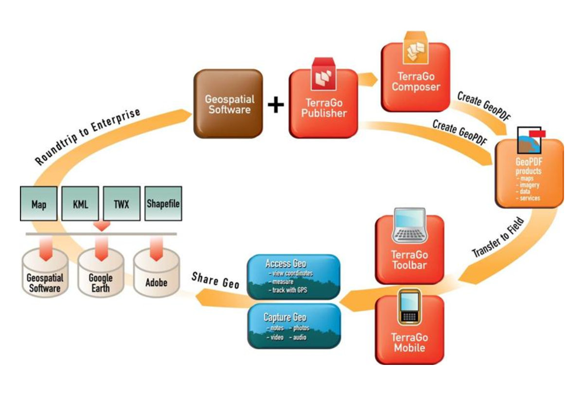
TheTerraGo Publisher Suite allows organizations to consume and optimize data from any source and create a geo-enabled PDF, also known as a GeoPDF. The TerraGo Collaboration Suite offers desktop, web-based, and mobile software applications that automate geospatial collaboration and information gathering.
TerraGo delivers software solutions that are relied on every day by leading smart cities & utilities and defense & intelligence organizations in all 50 US states and over 70 countries around the world.
TerraGo’s field applications are being utilized by a global customer base including Chicago, London, Jamaica, Toronto, Glasgow, Minnesota, Rhode Island and Illinois (ComEd).
TerraGo’s geospatial intelligence products are used by the US DoD, Army, Navy, Air Force, Marines, NGA, CIA and over 20 partner nations.
GeoPDF ® Products
Share your GIS data, imagery and geospatial assets as feature-rich, interactive GeoPDFs that can be utilized by any user, with free software, on any device, in any location, even without a network connection.
GeoPDF Publisher
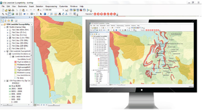
GeoPDF Publisher® for ArcGIS® enables organizations to significantly enhance the value of their existing GIS systems by producing and exploiting portable, interactive and intelligent GeoPDF® maps and imagery that can be easily updated and shared inside and outside the organization with anyone using the free Adobe® Reader®. Publisher seamlessly integrates with Esri® ArcGIS and extends the value of ArcGIS workflows, transforming geospatial intelligence into a vital collaborative asset for the entire organization, particularly for users without GIS training and software.
GeoPDF Composer
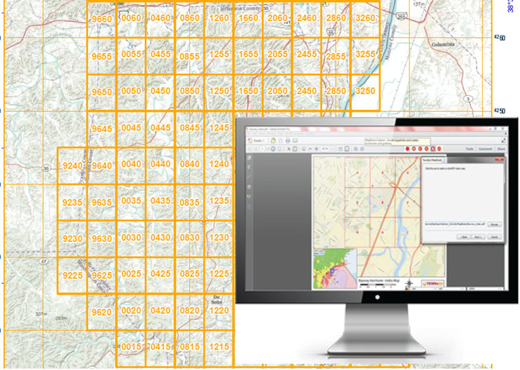
GeoPDF Composer® for Adobe® Acrobat® enables organizations to create portable, interactive GeoPDF® maps and imagery, GeoPDF mapbooks and other applications that combine geospatial data, business logic, Web services and other features into a variety of mission-critical location intelligence products that support information gathering, deliver situational awareness and drive decision-making across modern enterprises.
GeoPDF 3D Composer
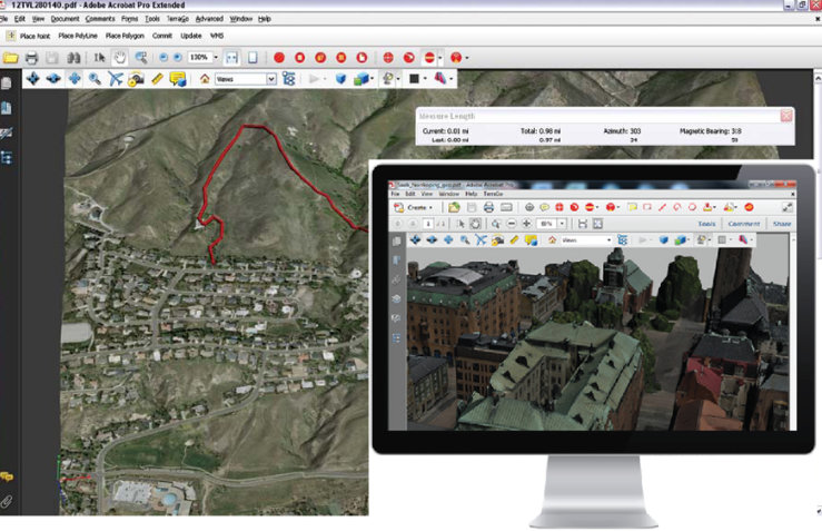
GeoPDF 3D Composer™ for Adobe® Acrobat® enables the creation of 3D GeoPDF® models that can be easily accessed and shared by people without advanced training or complex software systems. Users can take LiDAR point clouds, digital elevation models, imagery, and 3D PDF models and create dynamic, interactive, three-dimensional GeoPDF models.
GeoPDF Mobile
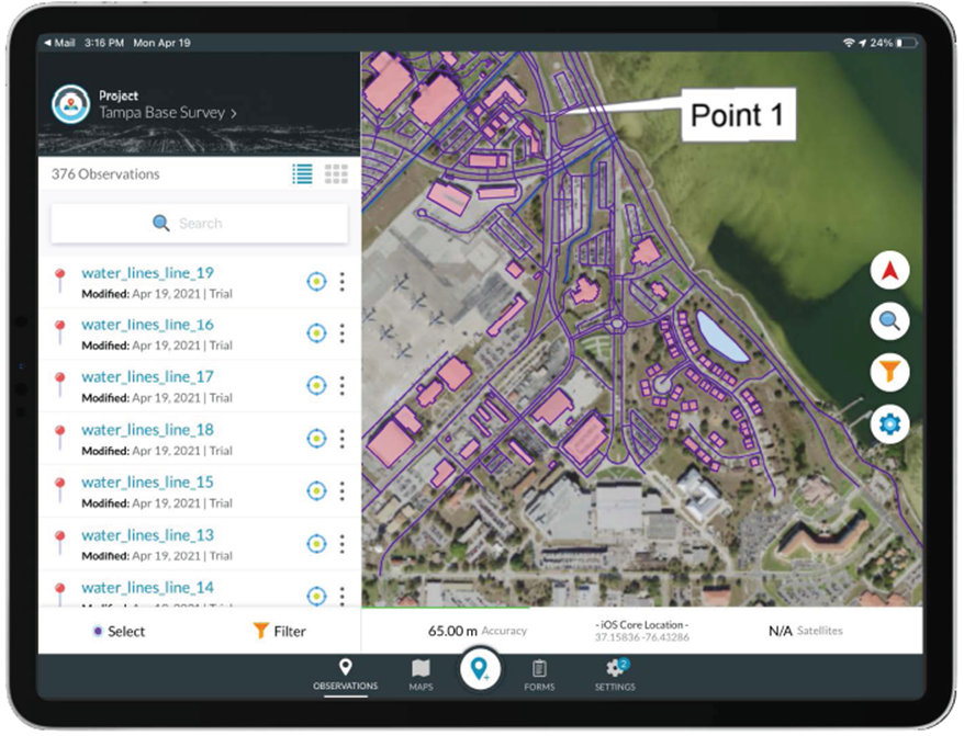
TerraGo’s GeoPDF Mobile application enables field personnel to work with GeoPDF maps on mobile devices, even offline without a connection, providing mission-critical geospatial collaboration even in the most remote terrains and hostile conditions. GeoPDF Mobile for iOS or Android allows users to view maps, see their location, navigate, record and share observations with other users, all with the performance and usability you’d expect from a native app.